Great Allegheny Passage Trail
Tuesday, September 8Aug 29 - Aug 30 - Aug 31 - Sep 1 - Sep 2 - Sep 3 - Sep 4 - Sep 5 - Sep 6 - Sep 7 - Sep 8 - Sep 9 - Home
[John's 75th birthday]
Today I rode from Connellsville to West Newton, 25.49 miles. I slept well after last night's dinner at the Valley Dairy Diner - pot roast with mashed potatoes, gravy and a salad. I slept in - at least in comparison to other mornings - and woke up around 7:15. I wanted to delay my start as long as I could since I knew it was a short day.
So I went downstairs and got breakfast and two cups of coffee, brought it back to my room and enjoyed it. Then I showered and exchanged a few messages with Steve. Finally, around 10:30, I packed up and left the Comfort Inn. I knew the forecast was for hot weather, so I crammed my three water bottles with as much ice as I could get in them. Two bottles go on the bike frame, and one rides deep inside the right pannier. It still had ice in it when I unpacked it four hours later. I also had some bottles of summer shandy left over from last night, and there was no way I was leaving those behind, so the right pannier was a little bit heavier today.
I stopped at the Martin's grocery store on the edge of town and got a freshly made ham and cheese sandwich. I had an apple and an energy bar from the breakfast grab-and-go bag at the Comfort Inn, and I figured all of these would make a dandy lunch.
I didn't recall a lot of interesting sights on today's route, but I knew about half of it was in the forest and a considerable amount was in more open valleys. So I made sure to apply sunscreen right away. I stopped just past Connellsville, after I passed a big KoA campground, to read a sign about all the coke ovens which had once been in the area. It's amazing how much these valleys were affected by the coal and steel industries. Indeed, the trail I am riding would not be here if it were not for the Pittsburgh & Lake Erie and the Western Maryland railroads which laid the road through the mountains. It was a hard way to make a living for a lot of people, and while the towns have shrunken (or disappeared altogether) since those industries have dwindled, what is left behind is something worth appreciating.
I photographed one of the white stone markers for the Pittsburgh & Lake Erie (P&LE) railroad because, on my outbound ride each time I saw one of them from a distance, it always looked like a happy white dog sitting there beside the trail. Like a Great Pyrenees dog. Several times I mistook it for one, but as I would get closer, I would see that it was just a railroad marker.
I came to the little park at Whisett Junction (the first water source after leaving Connellsville) around noon, just in time to sit and have a leisurely lunch. I was the only one there for about 30 minutes, then a hiker stopped for a few minutes, and some cyclists passed by. A much quieter day on the trail today. I lingered over lunch, sent a few more messages to Steve and told him the unique feature of this little park is that it has a flushing porta-potty. I've never seen one. It would be a hit on RAGBRAI. The park has a nice picnic shelter, ball fields and tennis courts, but it's clear that it's a stop frequented by trail users. Next to the hydrant for fresh water, someone had placed a bar of soap on a table. Soap and water is a genuine luxury on a bike trail, and I'm sure others appreciated it as much as I did.
I pulled out of the park at Whitsett a little after 1 pm and headed down the trail. A cyclist behind me was moving a little slower than I was, but I think he noticed when I signaled to him to look to the left when he reached the spot I had just passed where a small doe was standing at the side of the trail. She was just barely in the foliage, not more than 10 feet from the trail, and calmly watching me as I rode past.
Occasionally, I would notice canoes or rafts on the river. They weren't moving very fast. The Youghiogheny is much wider and moving more slowly in this area, making its way to join the Monongahela at McKeesport.
At mile marker 102 (I'm counting up to 150 to reach the end of the trail at the confluence point at Pittsburgh), I passed under Interstate 70 and thought of all those poor suckers, sitting in their cars, moving too fast.
Not long after that, I rolled into West Newton, my stopping point for the night. It was ten minutes before 3 pm, which was good because it gave me time to go to the visitors' center and buy a GAP Trail jersey. I've seen others wearing them, and I've so enjoyed this trip that I think I'd like the souvenir. I also looked at my email messages to verify the B&B check-in time and found that this one allows check-in at 3 pm, so I went directly there after leaving the visitors' center.
It's a little before 5 pm now, and I've already had my shower and done my laundry, which is hanging on a line in the back of my B&B house. The bottles of beer survived the ride - I was a little concerned, because they are twist-off caps, and I did hit a few good ruts in the road. I really didn't want to open the pannier and find everything marinated in summer shandy. Before I unpacked all my other stuff, I stopped in the guests' common area of my B&B house (this one has four houses) and put one bottle of beer in the freezer and the other in the fridge. It was nice and cold when I finished my shower.
I'll walk down the trail in a bit to the Trailside Restaurant, about 100 yards from the B&B. I recall that they have a rather tasty hamburger, and that sounds good for my supper.
Tomorrow, I will ride from here back to Pittsburgh. The route I mapped is 34.9 miles, but that was from my starting point at the First Avenue parking garage, and I intend to ride a little further - all the way to the Point State Park (the confluence of the three rivers), which is the official end of the trail.
Today's lessons:
It's good to take time to appreciate little luxuries like a cold beer or soap and water.
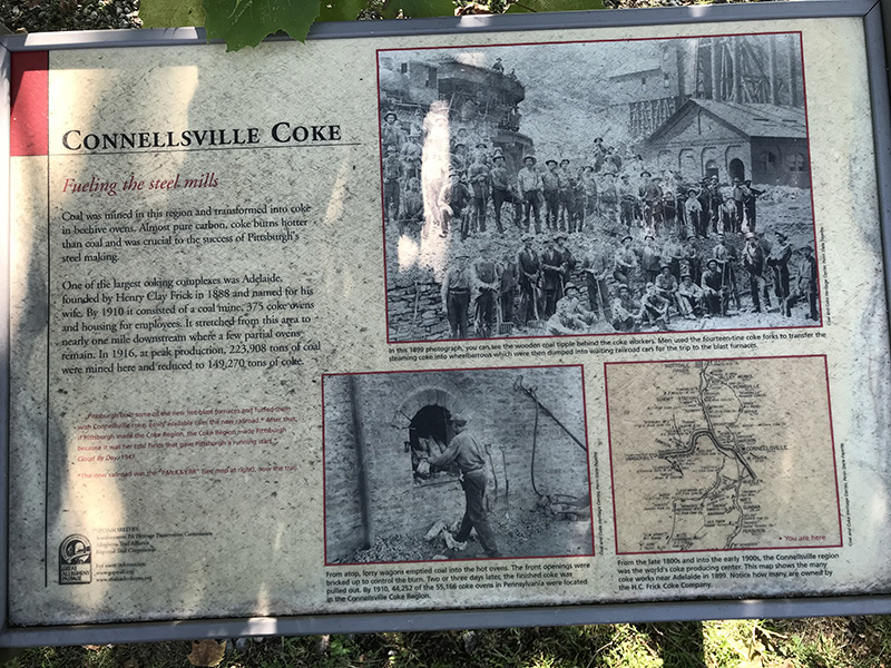
A sign about the coke ovens in the Connellsville region - for better readability, see https://tinyurl.com/yy4avj6y
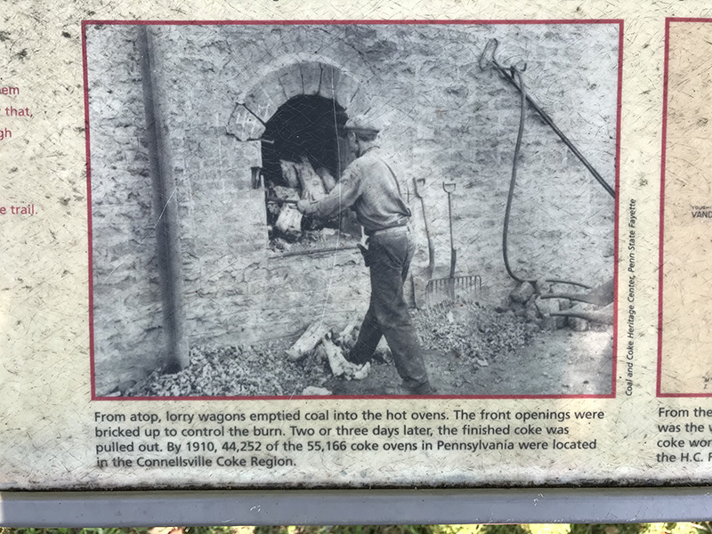
Worker at a coke oven

Map with locations of coke ovens in 1899

Marker for the Pittsburgh and Lake Erie Railway - from a distance, I thought they looked like a big happy white dog

PL&E RR marker ahead...
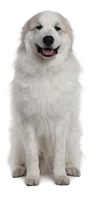
Use your imagination - maybe even just a little?
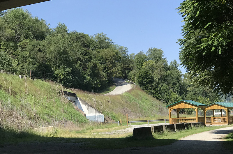
I photographed this because it illustrates nicely the advantage of a trail on an old railway. Motorists in the area will drive some steep climbs (on the left in this photo) vs. trail users traveling on a path which avoids the steep grade (on the right). The roads are often narrow and winding - not much room for bicycles. That's why it is usually not advisable to depart from the trail and try to bicycle the local roads. Unless you're knowledgeable about the route (and have the corresponding fitness level), it can lead to misery.
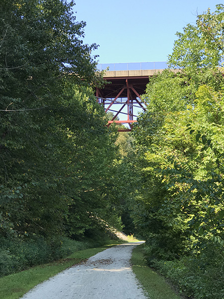
Interstate 70 passes over the GAP Trail near Smithton, PA
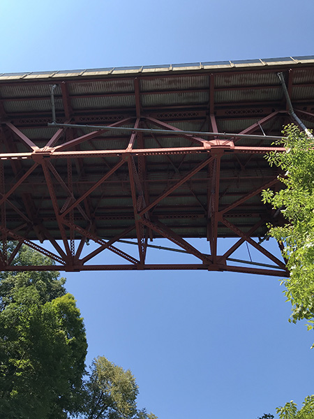
Interstate 70 passes over the GAP Trail
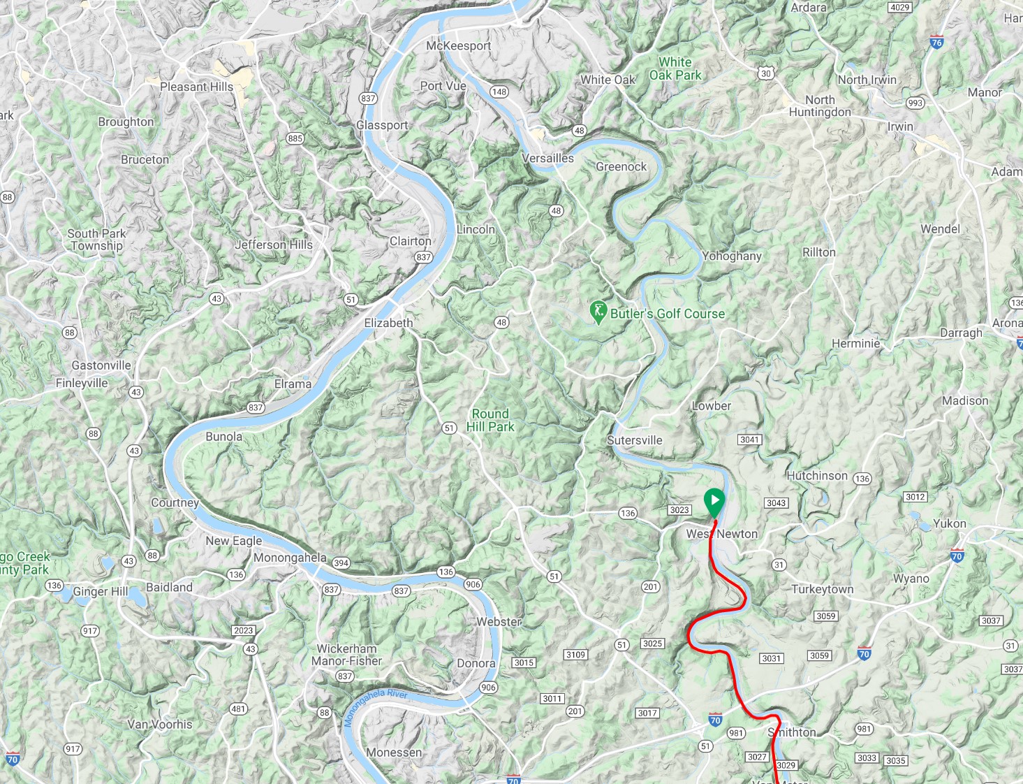
Map showing the day's route and river confluence at McKeesport
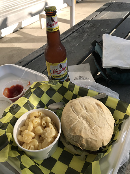
Beer and burger from Trailside Inn at West Newton. The mac and cheese was a nice side dish!
Next - Wednesday, September 9
Back to Top of Page
Back to Home Page