Great Allegheny Passage Trail
Friday, September 4Aug 29 - Aug 30 - Aug 31 - Sep 1 - Sep 2 - Sep 3 - Sep 4 - Sep 5 - Sep 6 - Sep 7 - Sep 8 - Sep 9 - Home
Today I rode from Meyersdale, PA to Cumberland, MD, a total of 34.69 miles with a climb of 1,224 feet and a 22-mile descent.
I left the B&B around 10 am and headed first for Sheetz, down the hill from my overnight place. There, I loaded up on ice and water for the water bottles, some energy bars, and a sandwich and fruit for my lunch.
The sky was overcast, but it wasn't raining, and the temperature was just around 60 degrees. I checked the radar and saw one little patch of rain to my west and decided I would wait for a bit and give Steve a call. He was having coffee and getting ready to start his day, so we didn't chat long. While we were talking, it started to rain, and I stayed under the eave of the Sheetz store where I was. A man who was filling his car with gas looked over my way and asked if everything was okay - he was wearing a bicycle jersey for the GAP trail and could see that I was also ready to cycle, and it's just a courtesy thing that bicyclists do. I thanked him and said yes, I was fine, and he went on with what he was doing.
By about 10:30, I was on the bike, pushing hard to get up the big hill from Sheetz back to the trail. I had put my rain jersey on, and before I reached the top of the hill, I was wishing that I had not put it on. I was fully warmed up once I hit the trail.
Today's ride took me across many stream crossings on old iron bridges or trestles and through several tunnels. I was still climbing slightly when I left Meyersdale, since I had not yet reached the Eastern Continental Divide, but that came along about 9 miles up the trail.
Shortly after that, I went through the Big Savage Tunnel - named for the Big Savage Mountain, and after emerging from it, I was greeted with a spectacular view across the valley. I could see for miles, even as far as the Narrows, the gap in the mountains leading to Cumberland, where I was to end the day. The Big Savage Tunnel was reopened only after much hard work from area organizations - click here to read more about how this and other projects opened a 300-mile continuous trail for recreational use.
My tandem friends, Stan and Sue, were there admiring the view. I found a bench near them and sat and looked eastward, too. It is such a stunning panorama and not one that I could take in in just a few minutes. But after awhile, it got hot sitting in the sun, and I decided to move to a picnic shelter a few yards off the trail and enjoy my lunch. Stan and Sue sat for a while, too, and we visited. Pretty soon, all three of us moved on down the mountain.
At this point, I was descending and would be riding down the mountain for the rest of the day - except for a brief stop at Frostburg, when I opted to take the switchback and ride up the mountainside to see a museum (which turned out to be closed because of COVID).
I had 22 miles of descending. At times, I picked up quite a bit of speed and actually used the brakes, and at other times, I needed to push the pedals two or three strokes. I was not strongly tempted to fly down the mountain as fast as I could because the surface was sometimes soft in places and there was some loose rock here and there. Especially with a loaded bike, it's easy to lose control in situations like that. There were also several railroad crossings which required caution.
I came to a dark tunnel (Borden Tunnel) with no lighting. It wasn't all that long, and it was smoothly paved, so I proceeded without dismounting. I almost immediately regretted that because once I was immersed in the darkness, I could feel that there was a fairly good downhill grade, and with only the light at the other end of the tunnel as my point of reference, I quickly was unable to judge my movement and speed. I started fishtailing a bit and quickly braked and brought the bike back under control. I reached up to switch on my helmet light, and a pathetic beam that was of no use was the result. That's when I remembered that I had not recharged the light for a couple of days. I could see a cyclist coming toward me with a headlight, and I just rode slowly and focused on holding my line. I was glad to get out of that tunnel, and when I unloaded my stuff in the hotel room tonight, the first thing I did was plug in the charger cable for my helmet light and my taillight.
The downhill ride continued for at least a couple more hours. Without the usual movement of pedaling, I could feel my shoulders getting tight, so I took some breaks now and then, especially when there was something interesting to see, which was every few miles. Not long after leaving Big Savage Tunnel, for instance, I crossed the Mason-Dixon line, and there was some interesting information posted at that location, as well as a cobblestone line running diagonally across the trail. I had entered Maryland.
A little further up the road was Frostburg, but the town is up on the mountain ridge, and the trail bypasses the town. If cyclists want to see Frostburg, they have to climb up a switchback trail and then climb again after connecting to city streets. I didn't especially long to see Frostburg, but I thought the carriage museum and the turn table at the top of the switchback would be interesting. I encountered my tandem friends at the Frostburg trailhead, and Stan assured me that I would easily be able to ride up the switchback. We stood and watched as another cyclist came down the trail, and I agreed that the incline looked doable. So off I went. The hairpin turns were a little tight for a pea gravel trail, but by the time I had ridden up and down it, I had figured out how to master them. As it turned out, the carriage museum was closed, and the turn table was a rusty hulk filled with weeds, but at least I could see the size of it and how it worked.
I cruised on down the mountain, stopping now and then to take a picture of a pretty view or to take a swig of water. Most of the ride down from Frostburg was parallel to the rail line. In places, it appears to be an inactive line, but when I came upon a tunnel that the bike trail shares with the rail line, there was a warning sign not to enter the tunnel when a train is coming. About five miles out of Cumberland, I came around Helmstetter's Curve, a big arching curve in the trail and the rail line, making a practical 180-degree change of direction. (This is a beloved spot for the trail and rail fans - so much so that when the farmer's barn was destroyed by an act of probable arson ten years ago, railroad and GAP Trail fans rallied to put things right again. Click here to read that story.) Most of the ride was not under the cover of trees, so the views were spectacular, and I also had to remember to stop and apply some sun protection, which I haven't needed for the entire week until now.
A few miles out of Cumberland, the gravel on the trail turned to asphalt, and the incline leveled off a bit. I was meeting all kinds of people heading the other direction, riding up the mountain. On the outskirts of Cumberland, I met a lanky older man and a woman cycling north, and the man greeted me with, "Welcome to Cumberland!"
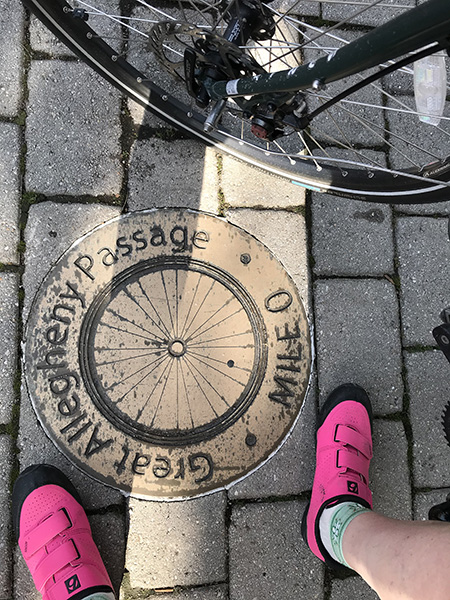
I rolled on through the Narrows, where Wills Creek cuts through the mountains and eventually joins the north branch of the Potomac. Right there at that point -- where actually two north branches of the Potomac come together, flowing around a little tip of West Virginia, and joining Wills Creek -- is the location of my hotel, the Fairfield Inn. I checked in, used the restroom and headed back out to my bike because I had not seen the "Mile 0" marker for the GAP Trail, and I wanted to find it and get a photo. It was just a couple hundred yards from the hotel - a brass medallion right in the middle of the trail (I had ridden right over it).
Back at the hotel, I unpacked a few things and hung up the slightly damp rain jacket and then left again to go have dinner at the Crabby Pig, located within walking distance. I had a Crabby Burger, a juicy grilled hamburger with a creamy-cheesy crab topping. It went well with my Leinenkugel summer shandy.
Back at the hotel, I toted all my dirty clothes down to the laundry, and now I have clean AND dry clothes for the next few days.
Tomorrow's 22-mile climb (2,577 feet of climb) back up to the continental divide is looming in my mind. It won't be easy, but I will take my time and know that I have a comfortable bed waiting for me in Meyersdale. As Drew has pointed out, I've climbed much further during several years on RAGBRAI (not usually in one day though, and not carrying 22 lbs. of stuff on a heavier bike).
Today's lessons:
Take time to appreciate the beautiful vistas in your life.
Do not overestimate your sense of balance in a dark tunnel.
_r.jpg)
Lunch supplies from Sheetz, packed inside my pannier
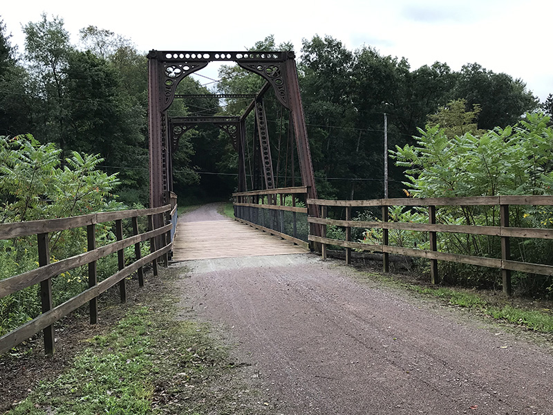
Bollman Bridge, near Meyersdale, interesting because of its construction and design
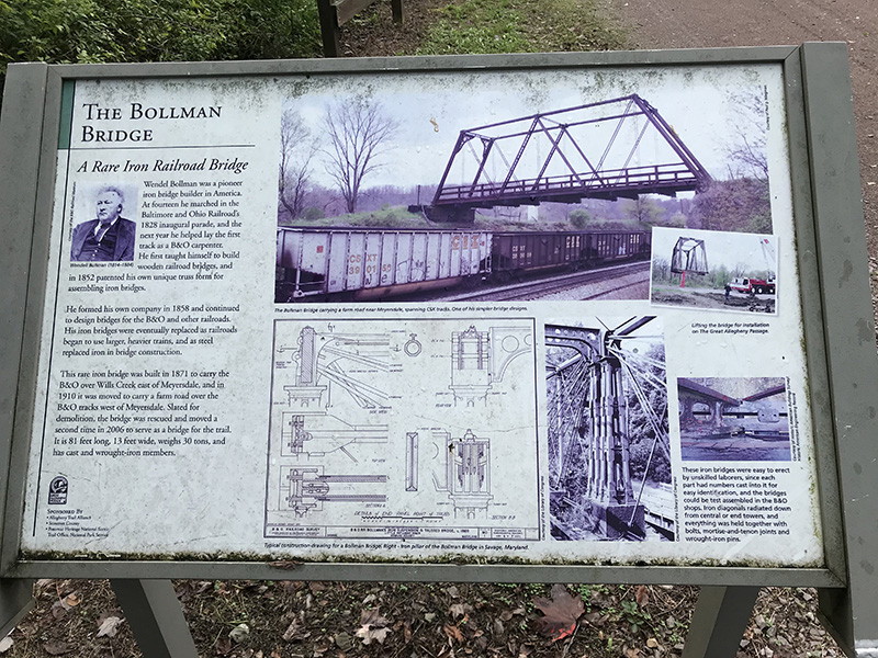
Sign about Bollman Bridge - for better readability, see https://tinyurl.com/y66zjon8
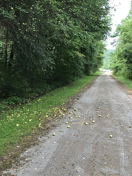
Actual road apples! (well, trail apples then)
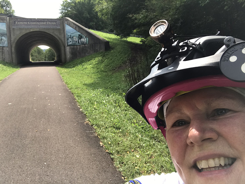
Reaching the Eastern Continental Divide, leaving the Mississippi River watershed and entering the Chesapeake Bay watershed
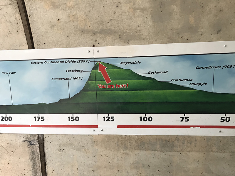
Sign inside the underpass for the Eastern Divide, showing elevations and mileage
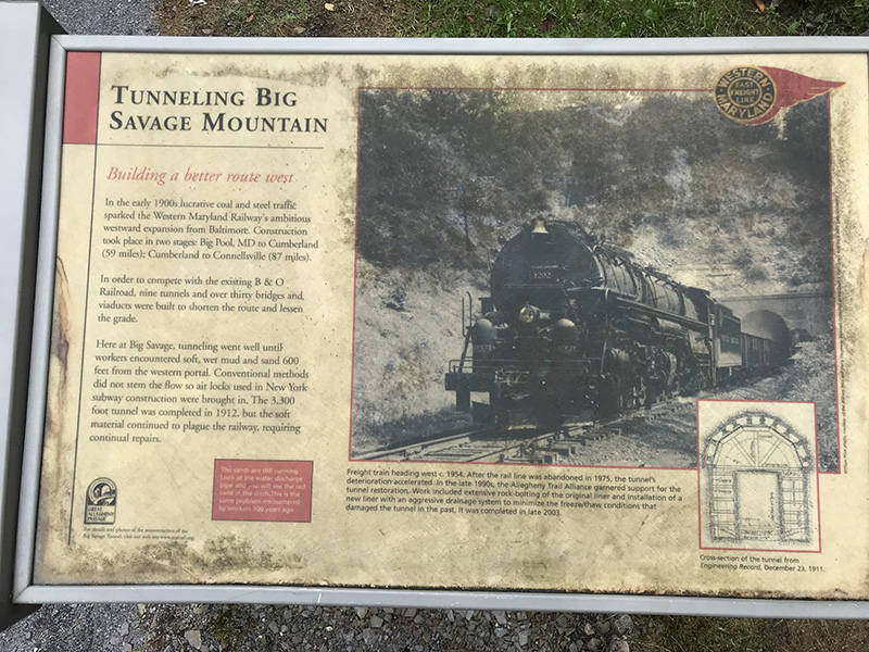
Sign about building the tunnel through Big Savage Mountain - for better readability, click here
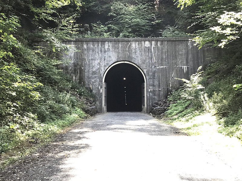
Entrance to Big Savage Tunnel - this tunnel is closed during the winter, and there is no easy alternate route, so if you plan to ride the GAP Trail, it is important to check for this and other trail alerts.
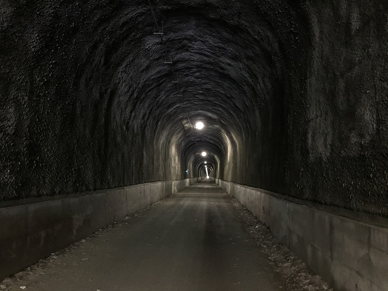
Inside Big Savage Tunnel (the French would paint murals on these walls - just because they can)
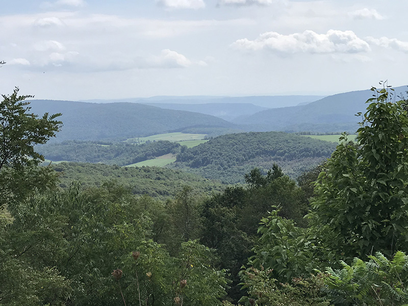
Marvelous vista from the eastern end of Big Savage Tunnel
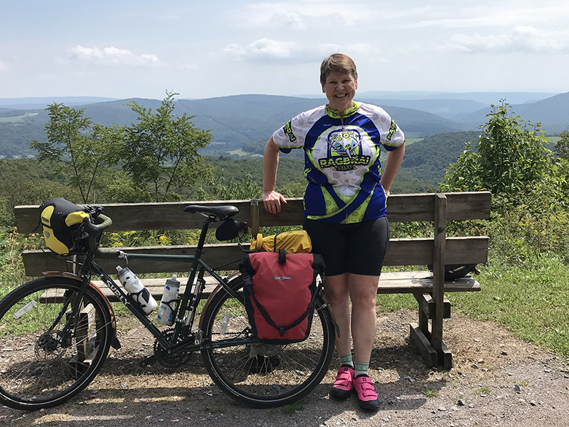
Molly and her bike, at the eastern end of Big Savage Tunnel
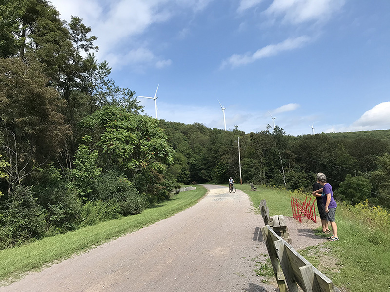
GAP Trail as it leads westward into the Big Savage Tunnel - there are windmills on top of the mountain
_r.jpg)
A sign about wind energy
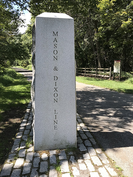
Granite marker on the Mason-Dixon Line, about a mile south of the Big Savage Tunnel
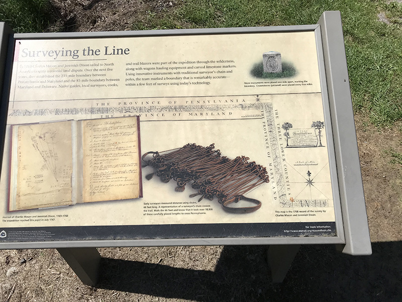
Sign about surveying the Mason-Dixon Line
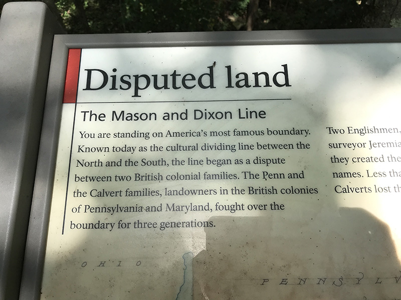
Sign about the Mason-Dixon Line - click here for an image of the entire sign
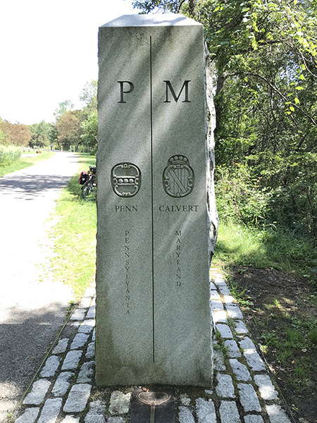
Other side of the granite marker for the Mason-Dixon Line
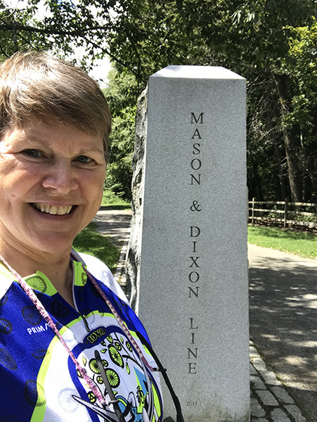
Molly at the Mason-Dixon Line marker
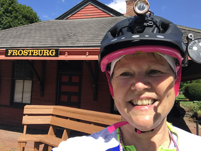
Old depot at Frostburg
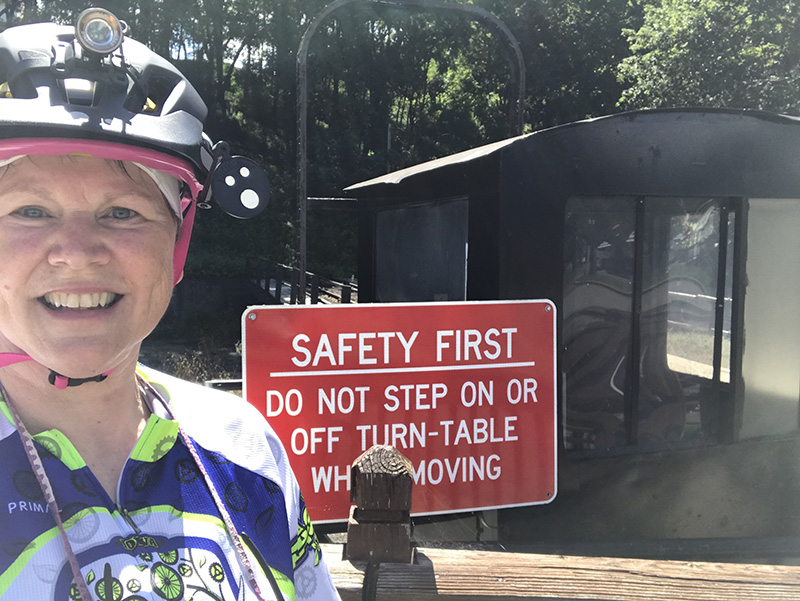
Railroad turn table at Frostburg
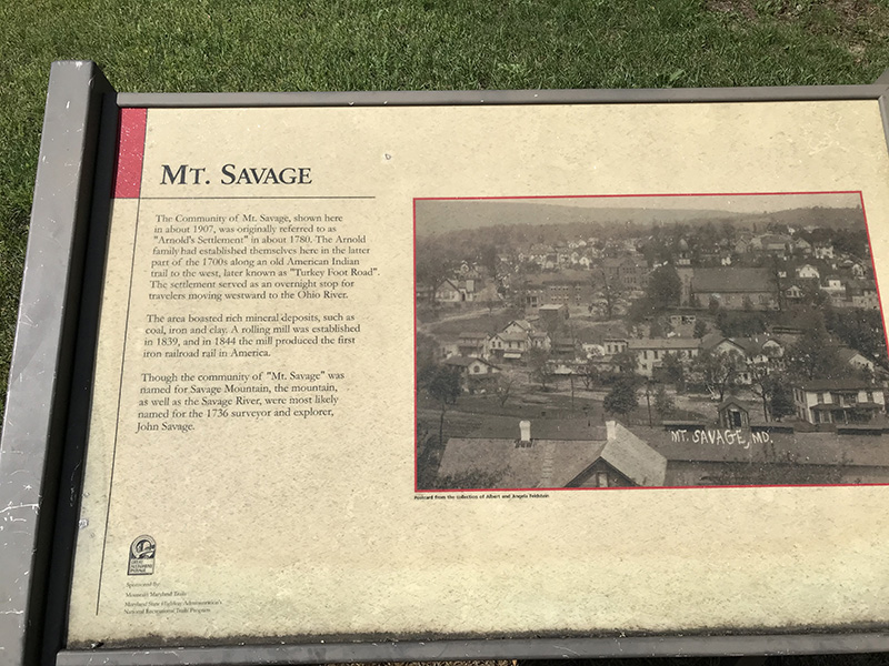
A sign about the community of Mt. Savage, known as Arnold's Settlement around 1780
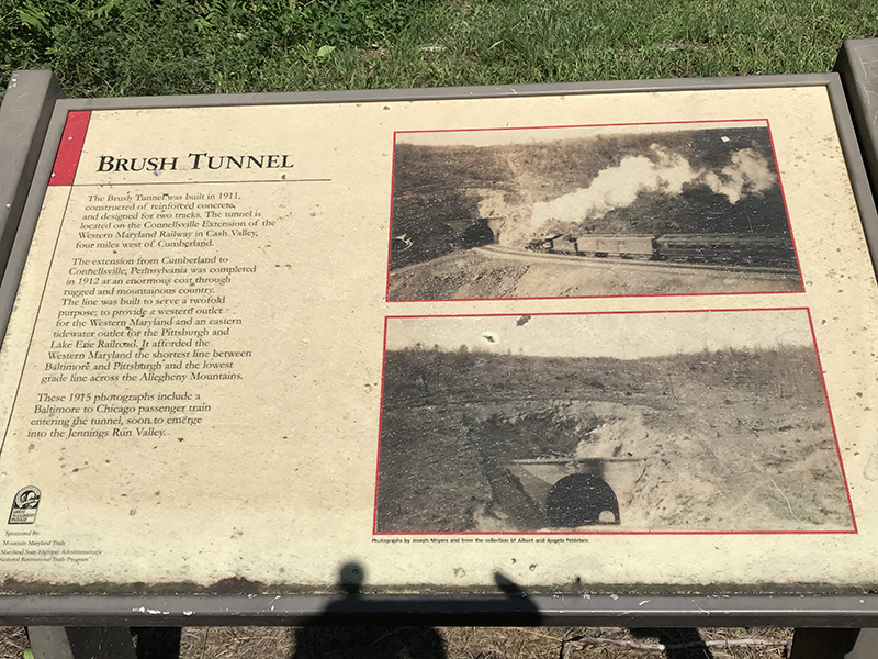
Sign about Brush Tunnel - a rail line and the trail both pass through this tunnel
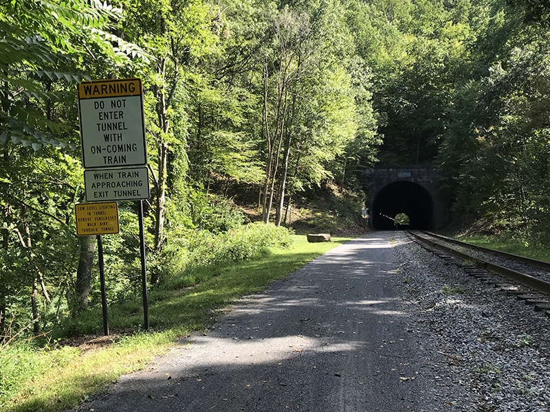
Brush Tunnel - with a sign that cyclists should not enter the tunnel when a train is approaching
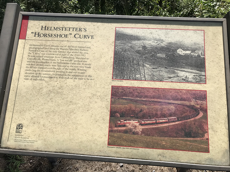
Sign about Helmstetter's Curve
On Helmstetter's Curve
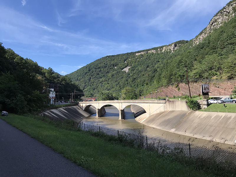
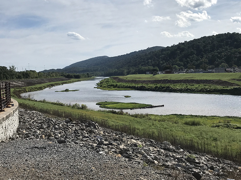
The trail and Wills Creek as it passes through the Narrows
The Narrows is a clear geological feature northwest of Cumberland, MD
Standing at Mile 0 of the GAP Trail in Cumberland, MD
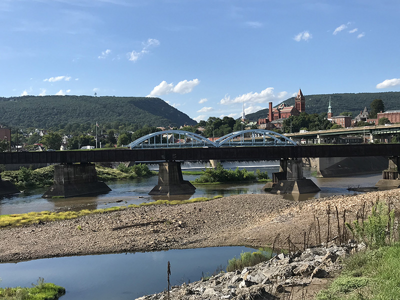
Cumberland, MD
North Branch of the Potomac at Cumberland, MD - a little piece of West Virginia lies on the other side of this branch, just yards from my hotel, and the C&O Canal Towpath continues along the river all the way to Washington, DC.
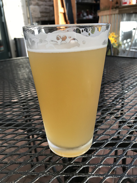
Leinenkugel's Summer Shandy - thought of you every time I drank one, Kathy McCartney!
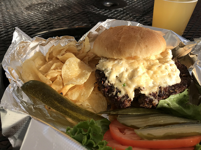
Crabby Burger from the Crabby Pig in Cumberland, MD (recommended!)
Next - Saturday, September 5
Back to Top of Page
Back to Home Page