Great Allegheny Passage Trail
Monday, September 7Aug 29 - Aug 30 - Aug 31 - Sep 1 - Sep 2 - Sep 3 - Sep 4 - Sep 5 - Sep 6 - Sep 7 - Sep 8 - Sep 9 - Home
Today I rode from Confluence to Connellsville - 28.41 miles (29.58 after the beer run from my hotel to Sheetz and back, and 30.48 after my run to the Valley Dairy diner for dinner)
As I was eating breakfast this morning, the air was a bit cool, and I wondered if I might need my jacket. But I checked the weather forecast - mostly sunny and high of 82 degrees - and decided definitely not. And in just the few minutes it took to pack the bags onto the bike, I got warmed up pretty quick.
I happened to notice as I was hanging the right pannier on the back rack that a securing bolt had come out of the rack and was lost. Uh oh. That's kinda important, and I wasn't carrying extras. But - aha! - it was a bolt from a braze-on in the frame, and I have several on the front end of the bike frame which are not in use, so I just moved one of them to that spot and then checked all of them to make sure none of them were loose. I was on the bike and riding away from the B&B by 10:05 am.
Since today's ride is not long and I need to wait until 3 pm to check in at the hotel in Connellsville, I wasn't in a hurry. I had time to appreciate some of the beauty along the trail and was especially fascinated at the activity on the river. For much of the way from Meyersdale I was riding along the Casselman River, but at Confluence, I crossed both it and the Youghiogheny and now was riding along the Yough, a popular river for rafting and kayaking. Off to my right, down the mountain slope, I could see a couple of kayakers and tried to get a photo of them, but they were moving too fast through the rapids, and there was too much foliage between them and me.
Not far down the trail, though, I came upon a place with wooden steps and a (relatively) safe path down to the water's edge. I parked the bike and went down, being careful to avoid the poison ivy along the way. As it turned out, I was at a point on the river with an island, and the kayakers went down the channel on the other side, so I missed them again. But I spied a fly fisherman, and I stood and watched him for a while as he worked his way down river.
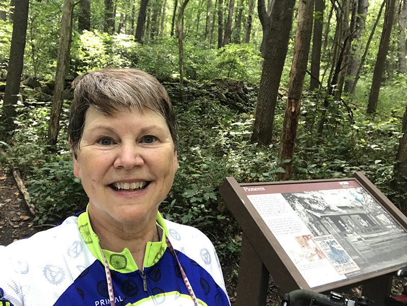
On down the trail, I stopped at an information sign about some early European settlers in the area, erected at a place with remnants of a stone wall in the forest. The marker made the point that there were few signs remaining of some of the earliest settlers, who were varied in their heritage. Perhaps the stone wall would have been something Irish settlers might have done, but it was a rather ramshackle wall by Irish standards.
I paused at a little cut through the rock which was heavily cloaked in greenery. I sent Annis a couple images and asked if they were mountain laurels or rhododendrons (we decided that they were the latter, but I am presently riding in the Laurel Highlands). This short little "canyon" was just covered with them, and it would be spectacular to ride through there when they were blooming.
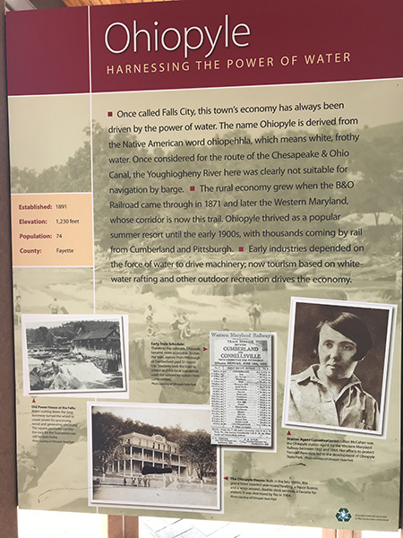
I planned to make an extended break in Ohiopyle - to get lunch, maybe some ice cream, and to just sit and watch people for a while. It was a good day for that. There were lots of people in the town, which is a popular jumping-off point for all the things to do in the region - bicycling, hiking, rafting, kayaking, picnicking, swimming. I stopped to use the restroom at the visitor's center, and there was a long line of people - all masked and socially distancing - moving through the five or six restrooms there.
When I came out and started to move my bike to a spot where I could watch it while I had lunch, a group of eight or nine riders rolled up and started assembling themselves in front of the "Welcome to Ohiopyle" sign. One of them was fixing his phone to a selfie-stick for a group photo, so I offered to take it for them so he could get in the picture. He thanked me and told the group I'd take the picture, and several of them took one look at my jersey and yelled, "RAGBRAI!" (A couple of them had done it last year, and the rest of them wanted to do it and had lots of questions.) They laughingly told the story how, during their RAGBRAI ride, it was rainy weather one night, and one of them suggested that they just go to a motel.
They insisted on my joining them in the group photo. I learned that they were from Pittsburgh, riding to Cumberland, and three or four of the group were going on to DC on the C&O Trail. I saw one of them later at a cafe, and he said the others were going to make "a quick side trip" to Fallingwater. I knew from driving those roads last Sunday that this was a crazy idea. They are much too steep and narrow for cyclists. The adventuresome ones must have figured that out rather quickly because it wasn't 40 minutes later that I saw the entire group sitting at a cafe.
I found a place where I could get a sandwich and sit outdoors in a shady spot. I also refilled my water bottles at this place because the water I had used from the B&B tap tasted too heavily chlorinated for me, and I knew I couldn't drink it all day.
After lunch, I pushed my bike along the sidewalks and crossed a busy state highway so I could get down to the water's edge and just people watch. Many others were doing the same. Young folks, old folks, dogs, parents and little people were all enjoying either walking along the river or - the braver (?) ones - going out into the current and sitting on or near the rocks where the river gives one natural massages. On the opposite bank, I could see that several hikers or picnickers had come down to the water's edge and were enjoying some of the last fine days of summer.
After enough people watching, I had worked up an appetite for ice cream and wandered over to one of about a half-dozen places in Ohiopyle that sell hand-dipped ice cream and got a dish of moose tracks ice cream. I sat at a picnic table in the shade and enjoyed it.
It was a little bit before 2 pm when I decided it was time to move on toward Connellsville. I had gotten nice and warm just sitting around in Ohiopyle, even while most of my time was in the shade. I stopped at the visitors' center one more time to use the restroom and decided that there were too many people in line (in a closed room with little air movement) and got on the bike and rode out of town. I figured there would be an outhouse before I got to Connellsville (there wasn't).
Once I was back in the forest, the temperatures were much more pleasant, and I cooled down quickly. The stretch of trail from Ohiopyle to Confluence is probably the roughest part of the GAP that I have ridden, and it's not all that bad - it just needs resurfacing on this part. There are several places with some dried mud holes or exposed rough rock. But I was going down a slight descent, and it was a much easier ride than the one I had made in the opposite direction. In about an hour's time, I was in Connellsville and checking in at the Comfort Inn.
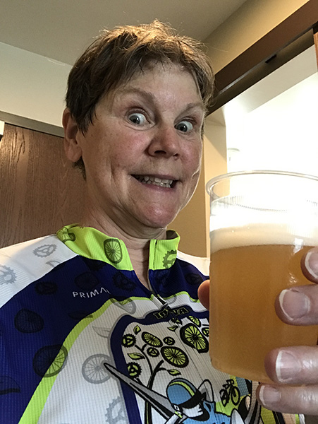
I really wanted a cold beverage, so after checking in and rolling Earl up to my room, I went to the vending machine to get a Coke. But it wasn't stocked with anything that even resembled a Coke, and the other choices weren't to my liking. The more I thought about it, I really wanted a summer shandy. So I put my bike helmet back on and rode down to Sheetz and picked up a six-pack. One of those quenched my thirst, and I took my shower and started my laundry. When the laundry's finished, I'm heading over to the Valley Dairy diner for dinner (it's either that or go across a bridge - and uphill - on the state highway to a pizza spot, and that doesn't sound appealing to me.)
When I bought the beer at Sheetz, I was carded (probably a state law for any package liquor sales - I don't care, I enjoyed it.)
Today's lessons:
Vacations make you younger.
Tree roots creating jolting bumps in the trail are strategically placed in stretches where you're looking for an outhouse/restroom.
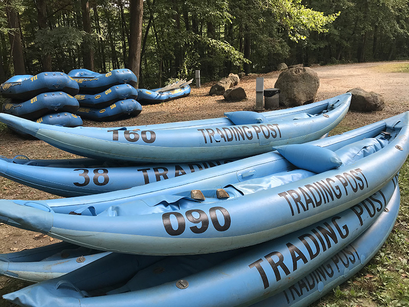
Stack of kayaks belonging to an outfitter near Confluence
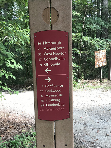
Trail signage along the route
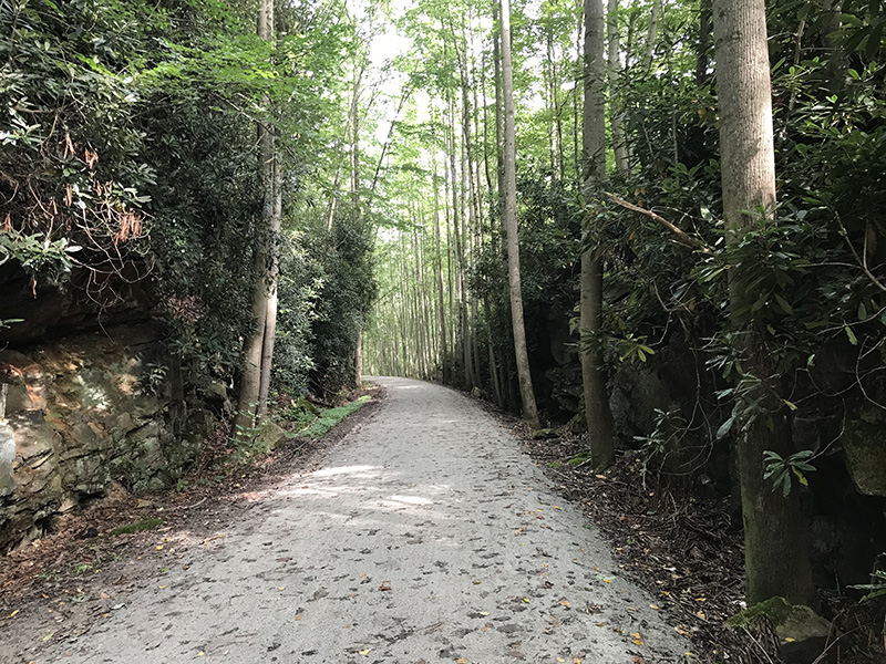
Rhododendrons on the rock walls along the trail
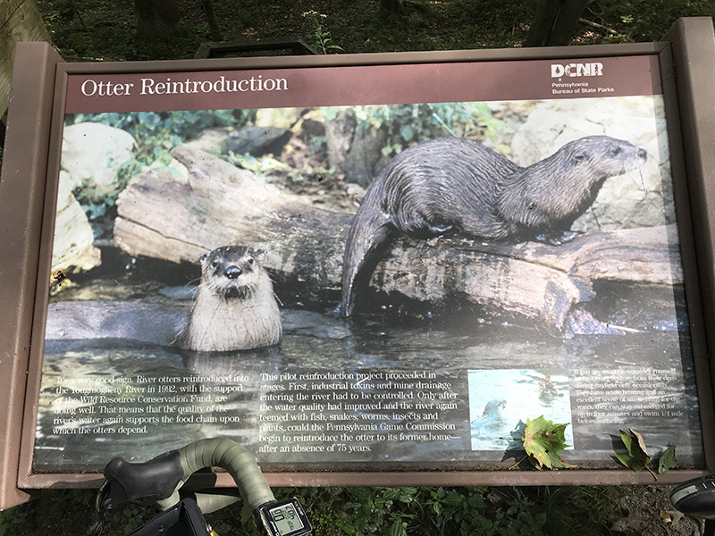
Sign about otters
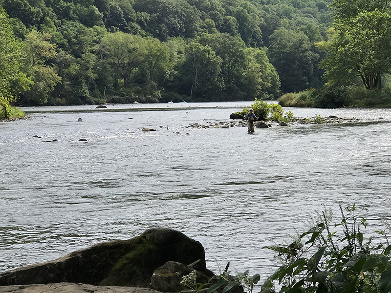
Fly fisherman in the Youghiogheny River
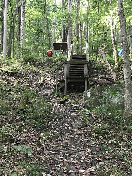
Steps from the trail down to the river
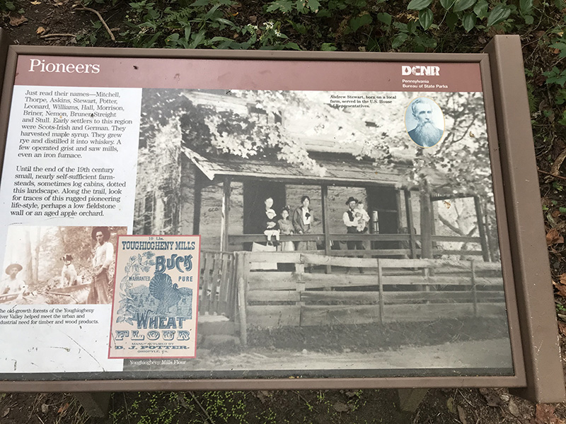
Sign about early European settlers
Molly along the trail where an old stone wall is in the woods
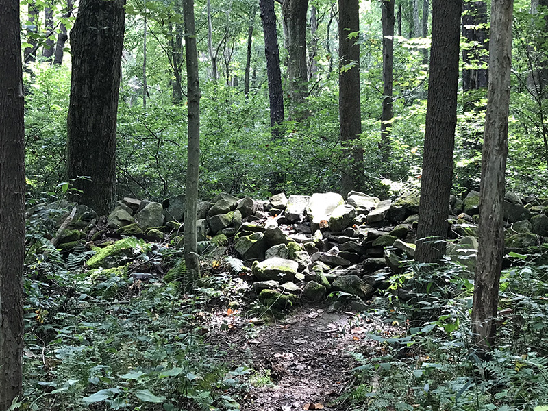
A self-respecting Irishman would be disgusted by this stone wall. Then again - keep in mind that this is a mere remnant of the past (and that there are snakes and poison ivy on the Allgheny Trail).
Sign for Ohiopyle
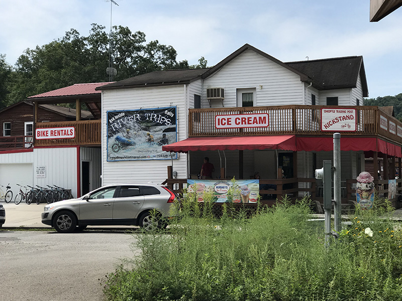
Ohiopyle caters to tourists - signs for ice cream are nearly everywhere, and you can also play a round of miniature golf.
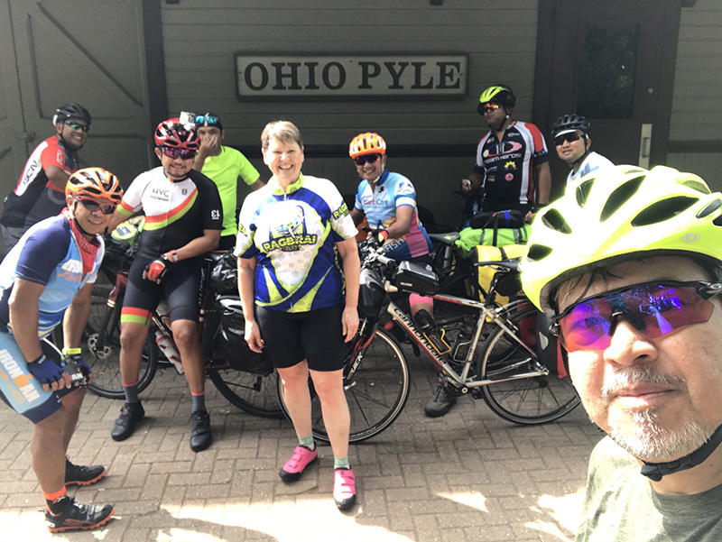
I offered to take their group photo and ended up in the picture with this friendly bunch.
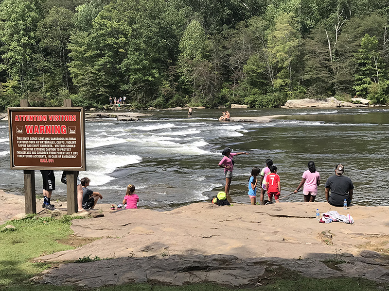
Families enjoy the river at Ohiopyle, but as the sign says, the river has hidden dangers and parents are advised to closely watch small children. Persons not familiar with the river and/or new to rafting or kayaking can sign up for a guided outing and also receive a safety course before venturing out on the river.
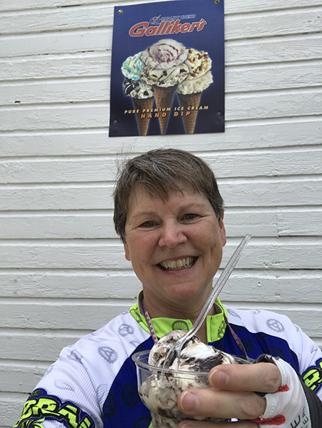
Energy snack in the form of moose tracks ice cream
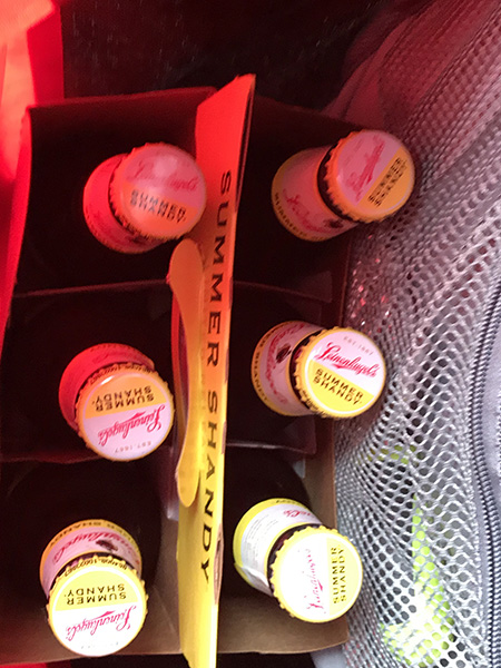
Booty from Sheetz - a 6-pack of cold Leinenkugel Summer Shandy being transported back to my hotel room
Molly, looking forward to refreshment
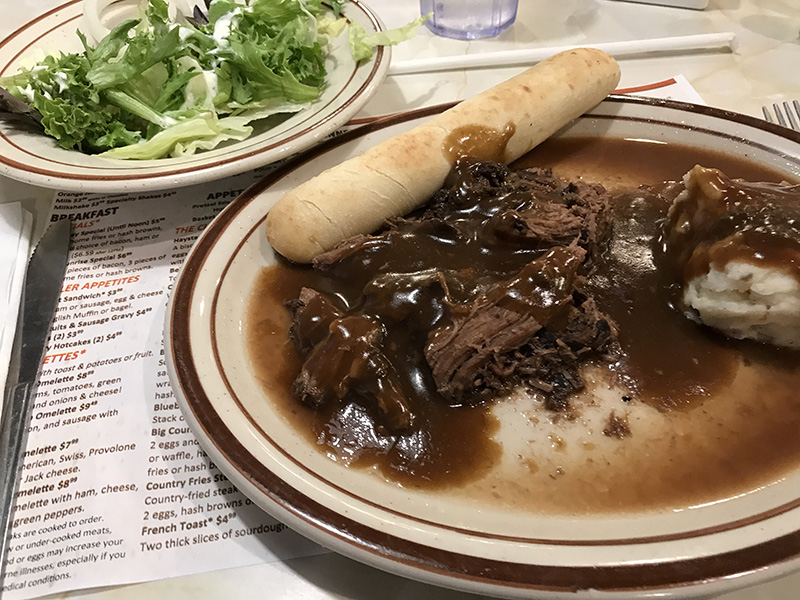
Pot roast from the Valley Dairy diner (this place also has a full breakfast menu)
Next - Tuesday, September 8
Back to Top of Page
Back to Home Page