Day 7 - Tuesday
| Today we rode 30.15 miles from Nijmegen to Arnhem
Today's theme was guidance/advice and the perils of ignoring it or lacking it After our breakfast at Hotel de Prince, we checked out of the hotel and retrieved our bikes from their storage. After reading the forecast, I had decided to wear my rain jacket to start today's ride, but I found it already too warm before I even got on the bike so switched to my lighter-weight windbreaker. Yesterday, at the end of the ride, my Garmin GPS device ran out of battery power and was in the "red zone" when I plugged it in to charge up. However, after being plugged in all night long, it would not power up this morning. This is frustrating because - when it works - the device saves us from having to try to follow a paper map or even a Google map while riding. The former usually requires frequent and often inconvenient stops, and the latter uses up too much battery power from the cell phones. Now, without a working Garmin device on the handlebars, my best option was to try to follow the printed cue sheet I have in my map holder. It's better than nothing, but it won't help me when I am entering a busy intersection or roundabout with car traffic coming from my right and left and bicycle traffic behind me and coming at me. Steve and I have identical Garmin GPS devices, and his was still working, so he turned his over to me. I had spent hours mapping each day's route and was more familiar with the course and the potential pitfalls, so I can usually more quickly interpret the information and directional arrows on the tiny screen of the device. We proceeded as planned, but for the next 30 miles, I was composing a letter to the Garmin company in my head. I am disappointed by the frustration that their product has caused, and now it has refused to work altogether. In an effort to jump-start its little arrested heart, I plugged my GPS device into a portable power supply I am carrying. I hoped that by the end of the day I would be able to turn it on. (Update: I received a message from a Garmin customer support employee, and they are processing a refund for my purchase of the European map I had downloaded for the device. This was a frustration I had before the trip even started. I found a workaround but was never able to use the map I had paid for. I will at least recover those misspent funds, but my enthusiasm for Garmin GPS devices is diminished.) After about 13 miles on the trail, we reached the village of Millingen aan de Rijn. This town is on the border of the Netherlands and Germany, and though our route did not take us to Germany, we were so close to the border that we cycled the half-mile further just to step inside the boundaries of another country and step back. Of course, there is really very little to denote the presence of a border at this point since the formation of the European Union. There is no gate, no line, no checkpoint - nothing except a sign with the symbol of the EU and the name of the country. We paused long enough to take a photo with the sign of each country and then rode back to the trail. Milligen is the point where we cross the Waal River for the final time. The ferry here operates on the hour - more frequently when there are more people wanting to cross, but this was not the case today. It was around 11:30, with the next crossing expected at noon, so we parked our bikes and went into a nearby cafe for a cup of coffee and some apple pie. A few minutes before noon, we headed down the path to the ferry and joined about five other cyclists who were wanting to cross. We were all touring cyclists, and the other folks were quite friendly. An older woman from their group stuck up a conversation with us, and we chatted about our different itineraries. She and her companions were riding a route to the southeast, and we were headed to the west. In our limited shared words, we compared experiences and equipment. As we parted ways, we wished each other a good journey. Not long after we got back on the trail, the weather turned to light sprinkles and eventually a light rain. We kept riding westward toward Arnhem and reached a second small ferry to cross the Nederrijn (Lower Rhine). At that point, I changed back to my rain jacket and was more comfortable. The ferry near Looveer had an interesting setup. The boat was tethered to a cable that was apparently anchored midstream, enabling an operation which did not require the ferryman to turn the boat but to swivel from the anchor point and use the current to his advantage. The cable holding the ferry was held above water by two small boats that moved in an arc across the river just as the ferry did. The other river traffic, knowing the operations of this ferry, simply pass on the side of the ferry that does not interfere with the cable. After landing on the other shore and riding a few more miles, we were ready for our picnic lunch (sandwiches we had packed from the breakfast buffet), and we looked around for a dry place to stop. The first opportunity was the underpass of a bridge of a four-lane motorway crossing the Nederrijn. We pulled up in a dry place and sat under the bridge to eat our sandwiches. We didn't stay long because the temperature had dropped and, while we were each wearing rain jackets, we don't bother with rain pants. Steve was wearing shorts, and I was wearing bike tights and our legs were wet. It's not so bad as long as we keep moving. A short time later, we came upon the approach to the John Frost Bridge at Arnhem (a bridge too far). This is the (rebuilt) bridge that the Allies held briefly during the failed Operation Market Garden. It is named for Lieutenant Colonel John Frost of the British Parachute Regiment. He led the lightly armed troops which arrived at the bridge on September 17, 1944 and tried to hold the bridge until replacements arrived. The replacements never arrived, and as the Germans forces closed in, Frost's troops sent the final communication - "We are out of ammunition. God save the King." We rolled across the bridge and down the ramp on the other side, through a small traffic circle and a little underpass to the Airborne Memorial. We paused for photos there, and Steve donned some warm tights since we had a few more stops (in the rain) before getting to our hotel. We stopped to see the Grote Kerk (St. Eubesius Church) and the neighboring Devil's House. Each had some interesting artistic features we were interested in, and the church also had a memorial tribute to the paratroopers - a couple dozen figures of paratroopers suspended from the ceiling of one of its chapels. Through a short alleyway and across the street, we found the Airborne at the Bridge Museum, a museum situated on the banks of the Nederrijn with a full view of the John Frost Bridge. We did not want to leave our bicycles unattended (since they were still fully packed with all our stuff), and the museum's bicycle parking was not located where we could keep an eye on the bikes, so we pulled around to the large window at the museum's side. There we leaned the bikes against a railing and went inside. An English-speaking museum volunteer, a Dutchman who looked to be a few years older than we, welcomed us and explained the museum's setup. We mentioned our concern for the bikes, and he said he would keep an eye on them while we viewed the brief introductory video in the museum's lower level. The video gave an illustrated view of the events of the Battle of Arnhem in a simplified version with captions in three languages - English, German and Dutch. After we watched it, we went back upstairs and viewed other exhibits, including several panels about the carrier pigeon named William of Orange, who carried a message back to England in record time. Because in-field communications at Arnhem were not functioning, the delivery of the message was critical information that prevented the loss of an estimated 2,000 soldiers who were withheld from certain slaughter. The pigeon was awarded a medal in 1945 - the Dickin medal - which, according to information at the museum, was instituted in the United Kingdom in 1943 to recognize extraordinary feats of animals. It has been awarded to 32 pigeons, 18 dogs, 3 horses and 1 cat. (Note: the cat's story is a good one. See this link: https://en.wikipedia.org/wiki/Simon_(cat). After we looked at the exhibits at the museum, we spoke at some length with the volunteer. He provided additional information about the course of the battle, showing us several photographs and diagrams that helped illustrate the events. After the Germans defeated the multi-national force at Arnhem (consisting primarily of the British, Canadians, and Poles), they ordered the residents of Arnhem to evacuate the city. Ninety-thousand people were given 48 hours' notice to pack up and leave. If a person did not leave and did not have an official permit to stay, he or she was shot on the spot. "They left the bodies on the street," the volunteer told us. We talked about the reasons for the Allies' failure at Arnhem, and the volunteer echoed what we have read elsewhere - the Allies (and particularly Field Marshal Montgomery, the British commander of the North West Europe Campaign) ignored guidance from various sources - the Polish general Stanislaw Sosabowski, Dutch Resistance leaders, Eisenhower and others - in drawing up an overly ambitious battle plan. It was interesting to discuss the events and their consequences with the volunteer because he has the perspective of someone who has grown up with the history as well as the knowledge of the feelings of other Dutch persons. Caught in the middle of the Axis and Allied powers, the people of Arnhem suffered greatly for what played out in their town. We thanked the volunteer for his work and for his generosity in taking time to answer our questions. Steve asked him if he had ever been to the U.S., and he said he had not - not because he didn't want to go but because his wife does not like to travel. We invited him to come visit, and (using a phrase we heard so often in Ireland) told him, "you would be very welcome there." We hopped back on the bikes and pedaled the few remaining miles to our hotel. It was about 5 pm by now, and we were getting chilly in our wet clothes. We just wanted to get in a warm place, unpack our things and have dinner. We found De Oude Herbergh in Osterbeek with no problems. It was almost a straight route from the museum. (In fact, much of our ride was along a similar route that John Frost and his men took from their landing point near Osterbeek to the bridge.) We checked in, stored our bikes in the back of the hotel, and found our room. The hotel has a popular restaurant, so we made a reservation for dinner at 7:15 and spent the time getting unpacked, taking warm showers and doing our laundry. At the end of each day's ride, we recharge lights, batteries, and cell phones. I looked at my non-responsive Garmin GPS device, and it was still refusing to turn on. I attached it to a charger plugged into the outlet. Nothing. I tried a different cable. Nothing. I held my thumb down on the "on" switch for about 30 seconds or longer. That did it - apparently this is the defibrillator-option for an arrested Garmin GPS unit. I think it is working again. But I'm going to leave it plugged into the charger all night away. Tomorrow's route will take us from Osterbeek to the Hoge Veluwe National Park, where we'll find the Kröller-Müller Museum with its collection of works by Vincent van Gogh, and then to our overnight spot in Otterlo. |
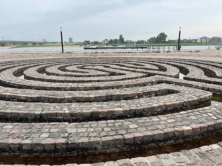
A labyrinth on the banks of the river at Nijmegen 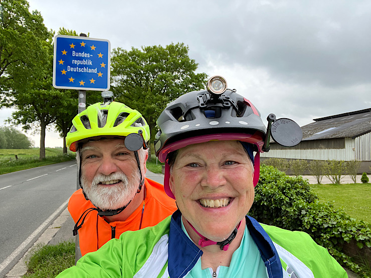
We crossed into Germany (for a few seconds) 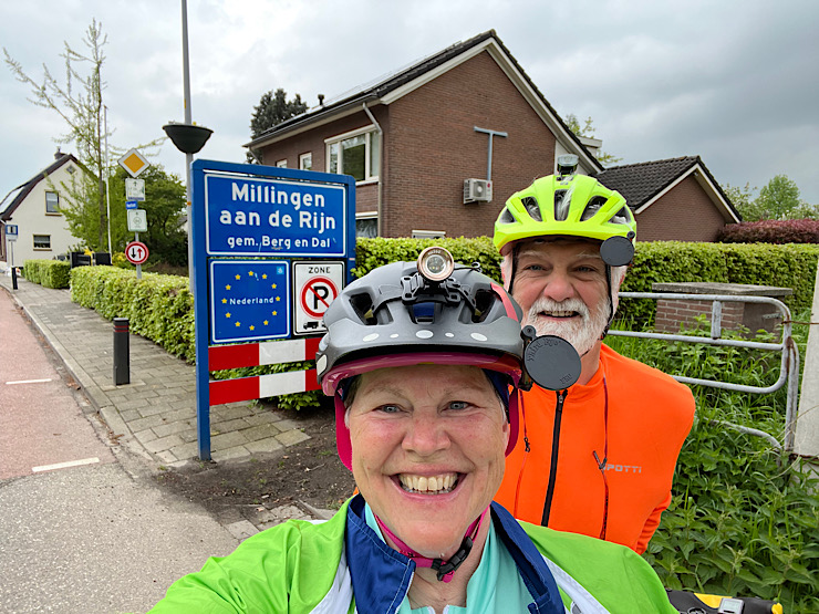
Arriving back in the Netherlands (after spending 5 seconds in Germany - at the border at Millingen aan de Rijn) 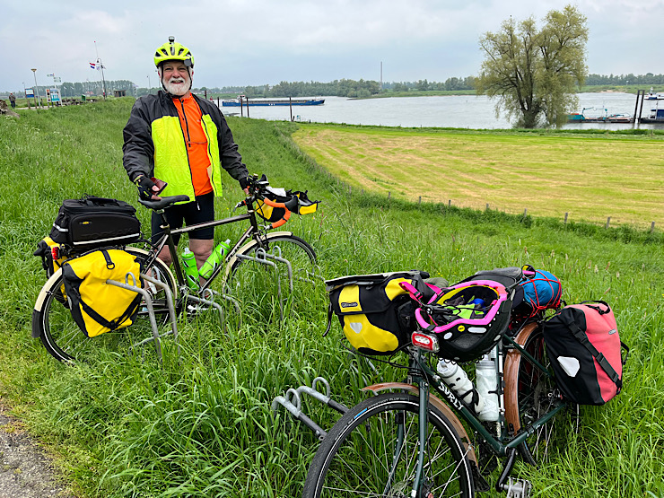
Bikes parked at the Gelderse Poort cafe at Millingen aan de Rijn 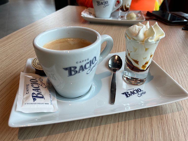
Coffee at the Golderse Poort cafe 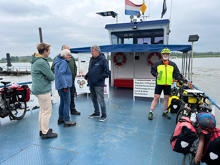
Friendly bicyclists on the ferry from Millingen to Pannerden 
The Rijnfietsroute (the Rhine Bicycle Route) sign near Pannerden 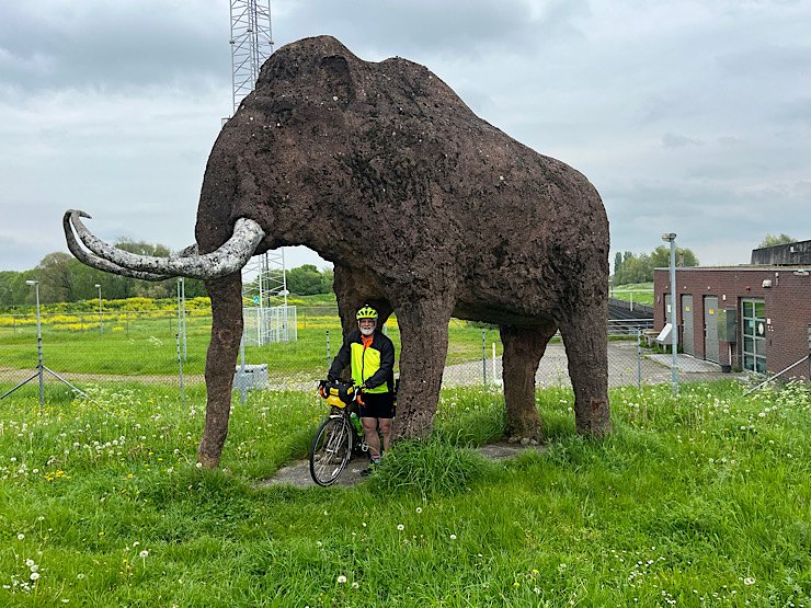
A wooly mammoth encountered along the trail (artist is Joris Baoudin - we saw another of his works two days ago) 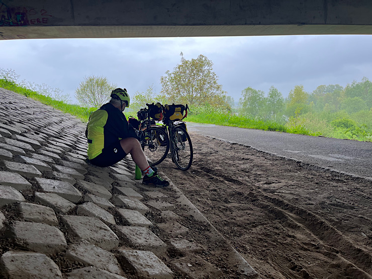
The rain caught up with us just east of Arnhem, so we had a picnic under the motorway bridge 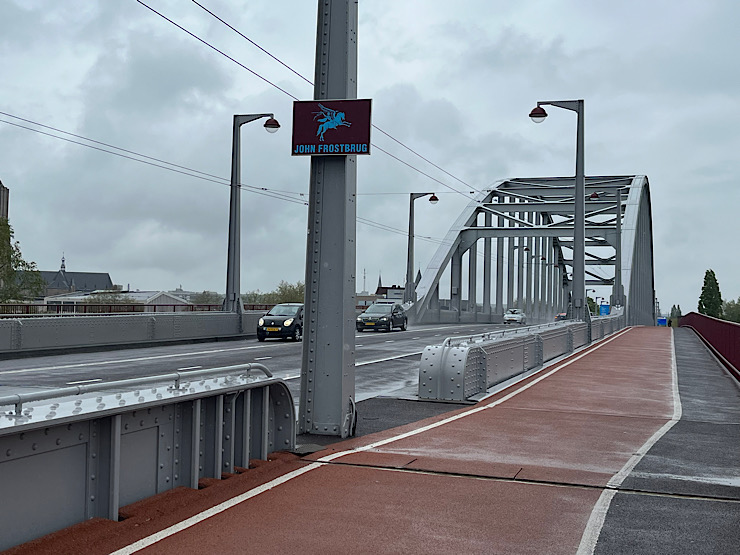
The John Frost Bridge at Arnhem - named for the British soldier whose troops captured the bridge and waited for the reinforcements which never came 
Airborne Memorial at Airborneplein in Arnhem 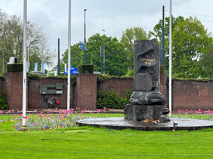
Airborne Memorial at Airborneplein in Arnhem 
Duivelshuis (the Devil's House), the 15th century home of Duke Charles of Gelre, called the Devil's House because of the devil-like figures which adorn the outside 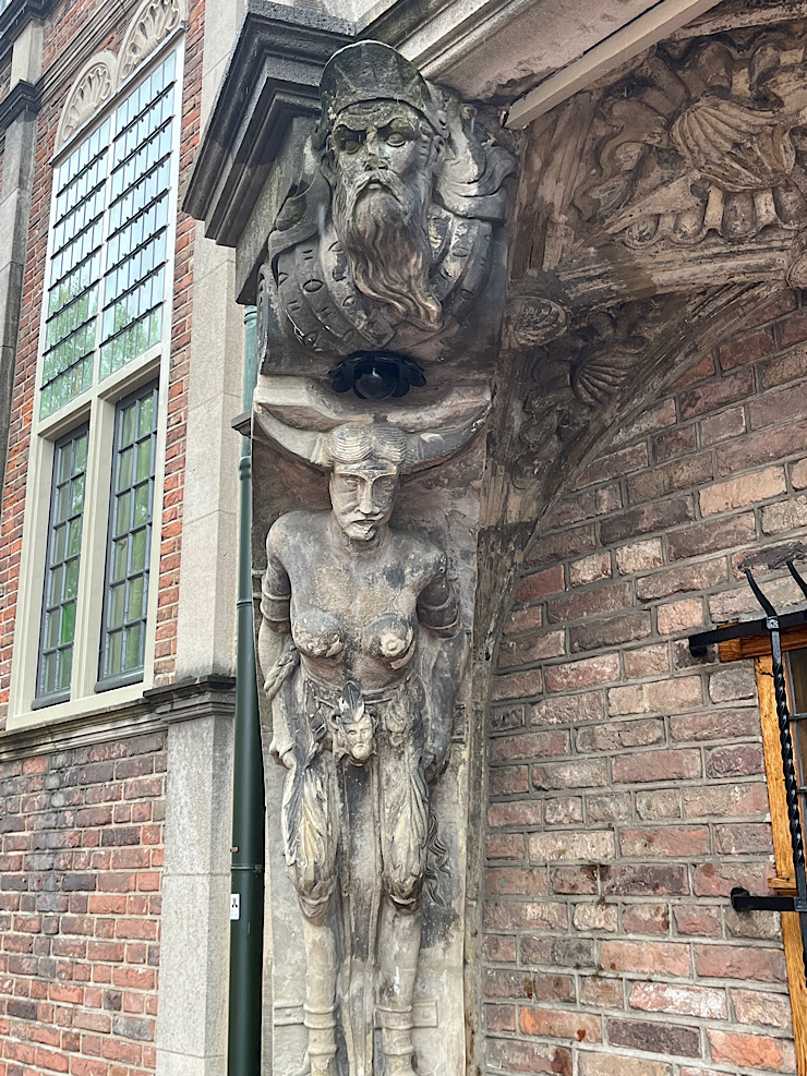
The figures on the Devil's House 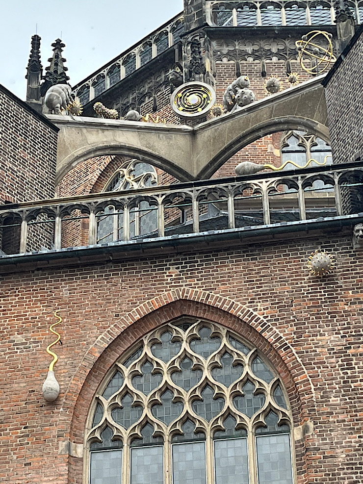
Organisms normally seen only under a microscope - artwork of Arno Coenen on Grote Kerk in Arnhem 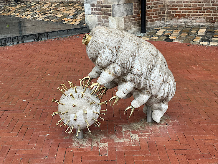
A water bear and a virus - microscopic organisms in a larger form as rendered by Dutch artist Arno Coenen. At the Grote Kerk (St. Eubesius) in Arnhem 
Text explaining the fate of the largest bell in the Grote Kerk at Arnhem 
The largest bell from the Grote Kerk, exhibited in a museum in the St. Eubesius Church in Arnhem 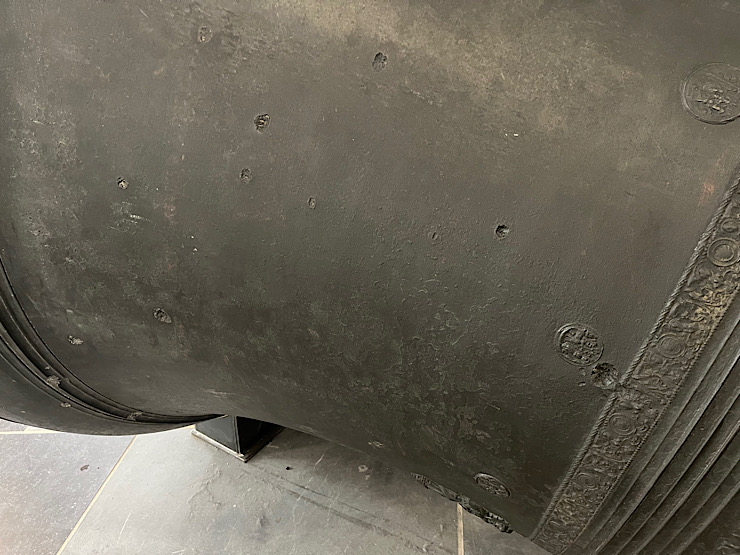
Marks on the church bell from St. Eubesius church, made by bullets from the 1944 Battle of Arnhem 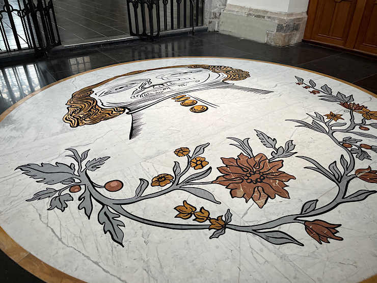
Mosaic on the floor of St. Eubesius church in Arnhem, made so that its reflection in an overhead polished chrome chandelier is an undistorted image of St. Eubesius 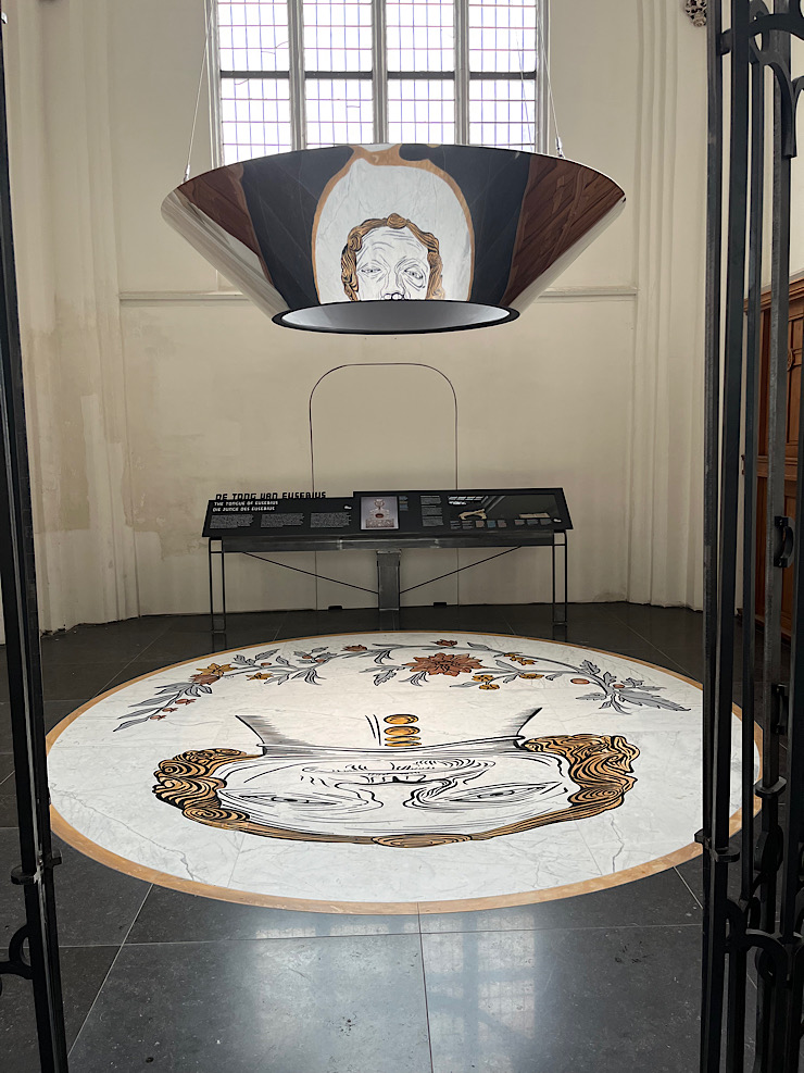
Mosaic of St. Eubesius and its reflection 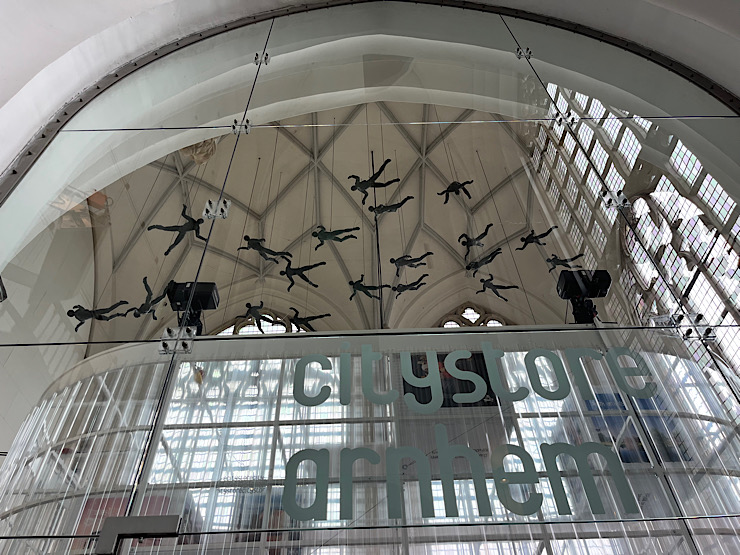
Paratrooper memorial in St. Eubesius Church in Arnhem 
An image from the exhibits the Airborne at the Bridge museum in Arnhem - the Arnhem bridge in October 1944, after the Allied bombardment to destroy the bridge 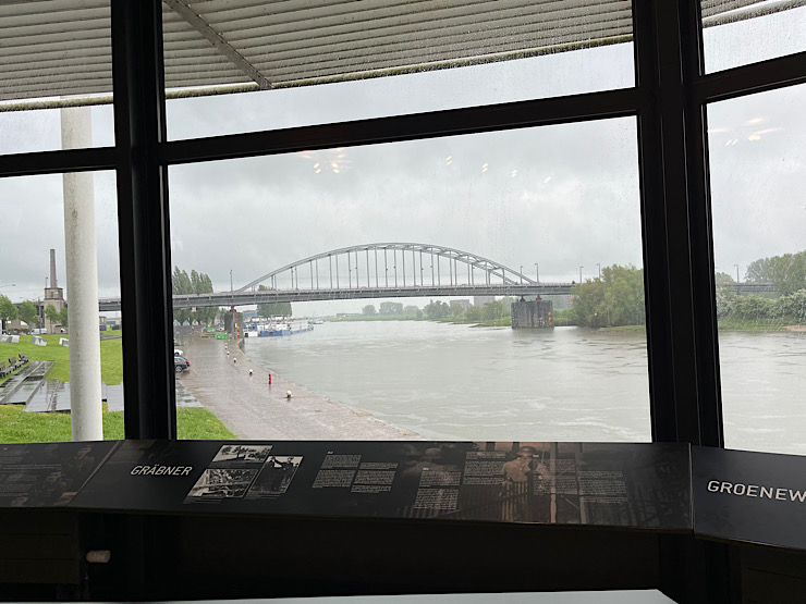
The John Frost Bridge at Arnhem, as seen from the Airborne at the Bridge Museum. After the liberation, the bridge was repaired and reopened on May 9, 1950 - exactly 73 years from the day we visited. 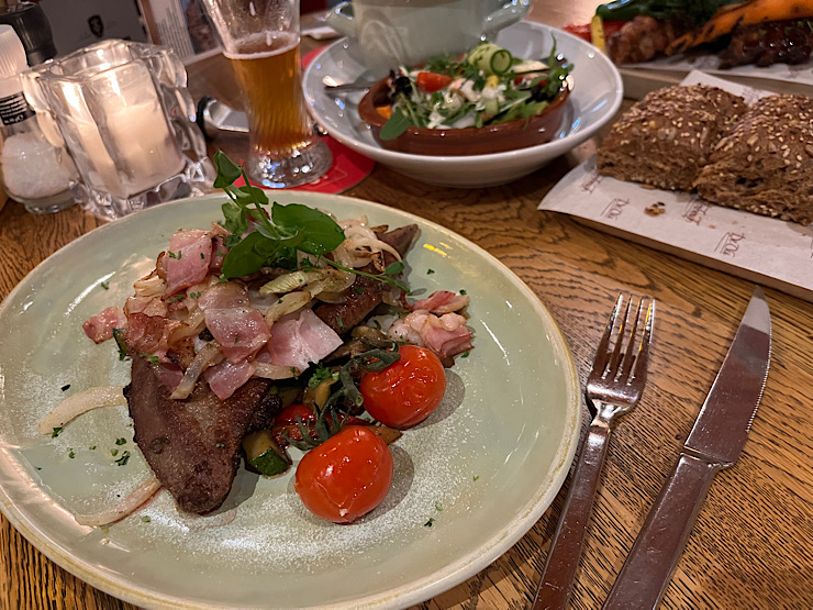
Dinner at De Oude Herbergh - liver and onions (with bacon) |
| Other travels |
|
back to the top |